


SKIPPER SATLOG SL1200
Part Number: SL1200
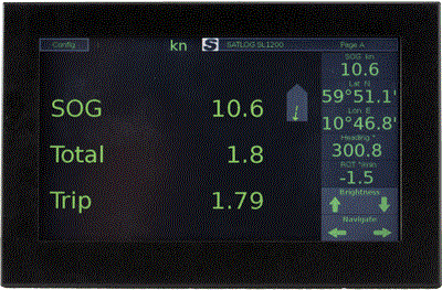
The SKIPPER SATLOG SL1200 is a three axis speed log. It is providing
longitudinal and fore/aft transversal ship speed over ground (SOG). The SKIPPER
SATLOG SL1200 provides accurate navigation parameters measured as they happen,
and presented in a logical, user friendly way.
Specifications: Speed Log: SL1200 Number of Axis: 3 Speed range longitudinal: +/- 99.9 knots Speed range transversal: +/- 99.9 knots Speed over ground from: 0 meter Temperature accuracy error: N/A Power Supply: AC:115-230 V 50/60 Hz DC: 20-32 V Power Consumption: - Display 5W - Elecronic unit 10W Display: - Multi - Panel PC 9" touch display, resolution 800x480 Mounting dimensions display: - Touch display: 224.5 mm wide x 140 mm high - Antenna: 100 mm height, 180 mm width and 790 mm long IP rating: Display: 2x Antenna: 66 Accuracy: <0.2 knots or 2% whatever is greater Weight: 1.2 kgs for Graphic display 3 kgs for antenna 2 kgs for electronic unit Standard cable length: Not included for the antenna. Needed cable is 4 TSP (Twisted, shielded pairs) minimum 0.5 mm2. Max length 100 m. Mounting options: Antenna only Speed alarms: High and low speed limits Power failure Sensor failure Outputs: 1xNMEA 0183 1xLAN (IEC61192-450) Inputs: 2xNMEA 0183 (IEC61192-1) 1xLAN (IEC61192-1) NMEA Outputs: VBW: Dual ground speed Distance: VLW VTG: Actual course and speed relative to the ground DDC: Dimming command output GPS: Gyro and status HDT: Actual vessel heading in degrees. ROT: Rate of turn and direction of turn THS: Actual vessel heading in degrees GSA: Satellite DOP and active satellites GSV: Number of satellites in view, satellite ID and evaluation SNR: Position and time signals GLL: Longitude and latitude of vessel position, time of position fix and status GGA: Time, position and fix related data STWL: Speed Through Water Longitudinal. If a SKIPPER DL2, DL21, DL850, EML224 are connected to the system via NMEA or LAN, the system can display both speeds, and also calulate water current based on the the SOG and STW values STWT: Speed Through Water from an inputted signal Note: This system is a speed log and cannot be used as primary source of other types of information. Position, course over ground and heading is only to be used as secondary sources Classification: IMO Wheelmarked MED-B Service: Available in most major harbours, world-wide through extensive dealer network Downloads available: Product Brochures Operation and Installation Manual Certificates Additional Installation Documents One full system consist of: Display: SL1200-SB Touch display Sensor options: SL-SN300-SA Satlog GPS and Glonass antenna Electronic Unit: JB40POW-SA
Features
- IMO Wheelmarked with MED-B
- Speed over ground (SOG) in three axis (Docking mode)
- NMEA 0183 output
- GPS and Glonas speed (SOG)
- Last time buy; 31.03.2026
- Last time shipment; 31.05.2026
- Last time installation onboard is 01.06.2026


.jpeg "36ea5bc6c5414ee3d34be7edb53e3763 (1)")
We are here for you!
We thrive to always answer your questions and meet your needs. Fill out the contact form, and we will get in touch with you.